Avoiding the Need for Re-Mapping in Localization Tech
We’ve discussed that having an accurate map of the environment is critical for self-driving vehicles and autonomous machinery to navigate safely and efficiently. All localization modalities require one.
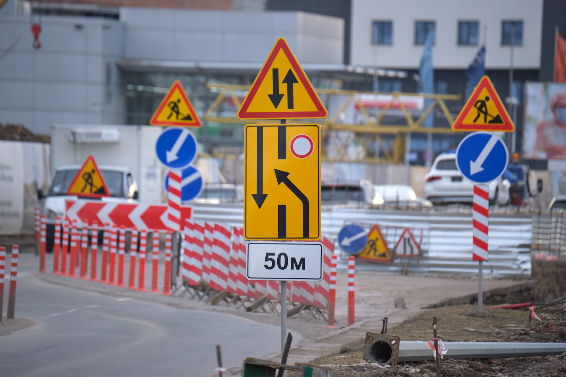
However, the world around us constantly changes—roads are repaved, buildings go up or down, construction pops up, etc. This is why change detection and frequent re-mapping are necessities for most localization and mapping technologies. It’s also one of the most critical challenges autonomous mobility faces for deployment at scale.
This blog will explore the concept of change detection, the need for re-mapping in traditional localization technologies, and how GPR’s WaveSense systems offer a scalable alternative.
The Challenge of Change Detection
Change detection involves identifying and responding to environmental changes affecting the vehicle’s navigation and safety. For traditional sensors like LiDAR and computer vision, these changes often necessitate frequent re-mapping to ensure accuracy and reliability.
Environmental changes impacting the data these sensors rely on are everyday occurrences such as weather conditions, seasonal variations, and human-made alterations. Every time a new driveway is poured, a tree planted, or a road line re-painted, the visual map needs updating. That means autonomous vehicle companies must often map multiple times per month in dynamic urban environments.
This re-mapping requirement is one of the key bottlenecks holding back the scalable deployment of autonomous vehicles and robots that use vision-based localization. The process is costly and time-consuming, and the AI/ML models must be periodically retrained on the new data. It’s a never-ending loop of mapping, operating for a period, detecting changes, re-mapping, retraining, and so on.
For autonomous operations, it is essential to find technologies that minimize this cycle.
Traditional Localization Technologies
LiDAR (Light Detection and Ranging) and computer vision have been the cornerstone technologies for autonomous vehicle localization. LiDAR uses laser pulses to create detailed 3D maps of the environment, while computer vision relies on cameras and image processing algorithms to interpret visual data.
While these technologies offer high precision, they are highly sensitive to environmental changes. For instance, LiDAR systems can be affected by rain, fog, and snow, which can scatter the laser pulses and degrade the data quality. Similarly, computer vision systems can struggle with varying lighting conditions, shadows, and occlusions.
Take autonomous trucking. The routes and conditions change frequently due to construction, seasonal changes, and varying traffic patterns. This requires LiDAR and computer vision systems to re-map regularly to account for these changes and ensure the vehicle navigates around them. Even offroad applications, like seaports, where the dynamic environment and constant movement of containers and equipment are unpredictable, require continuous map updates.
Ground Penetrating Radar – A More Permanent Mapping Solution
However, there is a technology that requires far less frequent re-mapping – Ground Penetrating Radar (GPR). At its core, GPR utilizes electromagnetic radiation to penetrate the subsurface, gather unique subterranean data, and generate maps of the terrain for localization. Originally developed for geological surveys and archaeological excavations, GPR has seamlessly transitioned into autonomous mobility, offering a novel approach to positioning.
By mapping underground utilities, soil boundaries, rocks, and other subsurface features, GPR produces maps with a higher degree of permanence than visual maps. While the above-ground environment may change frequently with construction, vegetation growth, etc. – the underground world is far more stable. This means GPR maps have longer effective lifespans and require re-mapping less often.
WaveSense is the leading technology using GPR for localization and mapping. The WaveSense mapping approach drastically reduces the re-mapping burden compared to surface-only systems. In many cases, only a single drive is needed to create a high-definition underground map suitable for autonomous operations. Then, that map can provide accurate localization for years with minimal need to re-drive the area.

Benefits Across Industries
The reduced re-mapping requirements of GPR make it ideal for a range of autonomous use cases:
- Autonomous Freight Trucks/Shuttles: For self-driving freight vehicles or campus shuttles operating regionally or between fixed locations, WaveSense minimizes mapping costs and disruptions. The routes can be mapped once and then operated autonomously for long periods, only needing intermittent re-mapping.
- Port Automation: The operating domains at ports and terminals don’t change underground very frequently. A single GPR mapping exercise could allow years of autonomous operations by port trucks, stackers, and other equipment.
- Mining Automation: Underground mines are one of the most attractive use cases, as the subsurface environment is obviously extremely stable, barring actual excavation activities. GPR allows high-definition seamless mapping of mines to automate haulers, loaders, and more.
- Warehouse/AMR Automation: Warehouses are typically controlled environments, but they still experience changes due to the reconfiguration of storage layouts and the movement of goods. GPR’s WaveSense system can provide a reliable localization solution by mapping the stable subsurface features and producing permanent maps for autonomous forklifts, AMRs, AGVs, and material-handling robotics.
Prospects of Mapping
While vision-based perception and localization will continue to play a critical role, GPR and subsurface mapping can dramatically reduce the mapping burden and costs associated with autonomous operations. Creating extraordinarily stable maps requiring minimal re-mapping could help drive scalability and widespread commercial deployment.
Technologies like WaveSense are pioneering this GPR-centric approach, minimizing mapping burdens for autonomous applications and mobility.
Contact us to learn more about GPR for localization at info@gpr.com