GPR's WaveSense Maps Unique and Consistent Data
Ground Positioning Radar (GPR) harnesses the unique and consistent characteristics of subsurface features to create highly accurate positioning data for autonomous vehicles. By utilizing low-frequency radar pulses that penetrate 2-3 meters into the ground, GPR generates a detailed map of the subsurface environment. This innovative approach offers several key advantages:
> Stability over time > Infrastructure-free solution > All-weather performance > Available day and night > Independent of GPS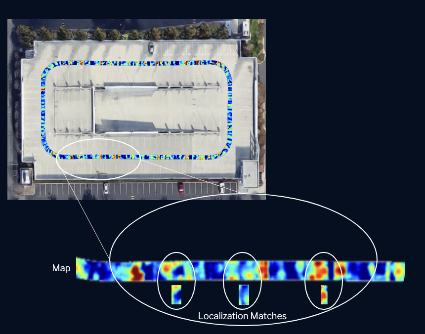
The Key to Robust Positioning
Map
Localize
Integrate
GPR Interfaces and Integrations
Ground Positioning Radar includes proprietary hardware, software, and algorithm design.
These components make up the WaveSense system.

Compatible Across Industries
Ground Positioning Radar™ provides automakers, Tier 1 suppliers, and autonomy providers with the localization performance and development tools to deliver new levels of safety and performance for their customers.
The character rich subterranean maps developed by GPR systems are being leveraged across commercial industries, including commercial robots, mining automation, passenger shuttles, seaports, and more.