Localization and Scalability in Autonomous Fleets
Autonomous vehicle (AV) fleets promise efficiency, safety, a reduced number of vehicles on the road, and reduced operational costs. The idea of navigating the roads without humans behind the wheel has captured our imagination for decades. But where are all of these promised vehicles? The “future of autonomous navigation” is still an “almost.”
In just the past few years, we’ve started to see AVs transition from niche experiments to wide(er) spread adoption. Scaling autonomous driving has become a priority across industries like logistics, public transportation, and ride-sharing. Yet rollouts still face some key obstacles, from ongoing safety concerns to regulatory approvals for custom vehicle designs.
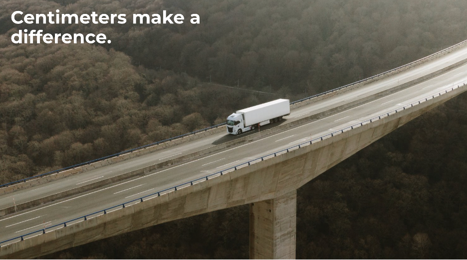
Typically tested in states with ideal conditions for most of the year, spreading to environments with adverse weather, lack of access to GPS, and changing road conditions remains a challenge, particularly regarding reliable and precise localization. A 10-centimeter positioning error could spell disaster for a commercial autonomy navigating many common driving scenarios.
This is where we will focus on today, solving the localization problem regardless of surface conditions, GPS reliability, and above-ground landmarks for global deployment of autonomy to accelerate.
Common Challenges in On-Road Autonomy: Positioning and Localization
Traditional sensors like Lidar, GPS, and computer vision systems play a crucial role in helping AVs understand their environment. Still, they have significant limitations when applied to real-world, dynamic conditions.
Scaling from controlled test environments to everyday driving requires overcoming the following:
- Urban Environments with Complex Geometry: Robotaxis must navigate busy urban settings filled with tall buildings, bridges, and tunnels that create “urban canyons.” These structures can obstruct GPS signals and disrupt localization, leading to positioning errors. To safely negotiate traffic in busy cities, AVs must reliably and continuously know which street and which lane the vehicle is on, which way it is heading, and its distance from road features that matter to the driving function, like distance from a crosswalk, a stopping line, or any other crucial lane marking.
- Poor Road Markings and Infrastructure Variability: Inconsistent or faded road markings, missing lane lines, or even just foliage on the road can pose significant challenges for AVs regarding positioning. Autonomous trucks, which frequently travel across state lines and through diverse regions, encounter a wide variety of road qualities that can confuse camera-based systems. These AVs may struggle to maintain their intended path without reliable lane information, particularly when changing lanes or navigating exits.
- Adverse Weather and Low Visibility Conditions: Weather remains one of the most significant challenges for autonomous vehicle localization. Rain, snow, fog, smoke, dust clouds, or direct sunlight can interfere with Lidar and camera sensors, reducing their ability to detect objects and boundaries accurately. Weather-induced sensor degradation can compromise safety and operational reliability for robotaxis, which operates in areas where adverse weather is common, and trucks that drive long routes across varying climates.
- Dynamic Environments and Construction Zones: Road construction, temporary traffic barriers, and frequent detours are everyday realities. These dynamic environments often change faster than AV maps can be updated, leading to confusion and positioning errors. Without the ability to adapt quickly to these changes, AVs risk veering off course, disrupting traffic, or causing accidents. To mitigate these challenges, current AV operations require a high refresh rate of data, which requires the operators to constantly re-scan and update maps, which is very expensive.
- GPS Signal Degradation in Open Roads and Rural Areas: When GPS signals are unreliable or compromised, they pose localization problems for AVs. Trees, hills, space weather, and other natural barriers can interfere with GPS accuracy, making precise localization challenging over long distances.
Safety is paramount for autonomous mobility, and AVs have no room for mistakes. Positioning errors can be catastrophic, potentially putting passengers, cargo, and other road users at risk. The challenge is even more pronounced when AVs operate close to pedestrians, cyclists, or other vulnerable road users.
Overcoming Challenges: A New Direction
The solution for the localization piece of the AV puzzle requires offering a redundant modality independent of the failure points listed above. A modality looking in a completely different direction to provide the most available and reliable localization, regardless of GPS and surface conditions.
Ground Positioning Radar (GPR) technology, like the WaveSense system, offers a transformative approach to overcoming these challenges. Unlike traditional sensors that rely on visible or above-ground data, GPR looks beneath the road surface, creating a subsurface map unaffected by surface-level changes.
Here’s how GPR addresses the most pressing localization issues:
- Subsurface Mapping for Consistent Localization: GPR scans the unique, stable subsurface of roadways—elements like soil layers, rocks, and buried infrastructure. These features are not susceptible to weather changes or above-ground obstructions, providing a reliable reference point for AVs to position themselves accurately in any environment.
- Unmatched Performance in Adverse Weather: GPR does not rely on visibility or clear skies, making it immune to the typical weather disruptions that impede Lidar, camera-based systems, and GPS. Whether it’s snow, rain, or fog, GPR provides consistent positioning data that keeps AVs on track.
- Independence from GPS Signals: By utilizing the subsurface as a roadmap, GPR operates independently of GPS, ensuring that AVs can navigate seamlessly through GPS-denied areas like urban canyons, tunnels, or densely forested regions. This independence is crucial for scaling fleets in diverse and unpredictable environments.
- Adaptability to Road Changes: Since GPR uses subsurface features for localization, it is unaffected by temporary changes to the road surface such as construction zones, lane shifts, or road wear. This capability allows AVs to maintain precise positioning even when the surface conditions are in flux.
How WaveSense Works: A Look Inside the Technology
WaveSense integrates three key components, GroundSense, NavSense, and MapSense, to deliver unparalleled localization accuracy using ground penetrating radar.
- GroundSense: Installed beneath the vehicle, GroundSense continuously scans the road’s subsurface, collecting data on subsurface characteristics that are invisible to traditional sensors. This raw data forms the foundation of a highly detailed map, capturing the hidden structure beneath the pavement.
- NavSense: NavSense is responsible for real-time positioning and navigation. It uses advanced matching algorithms to compare live subsurface scans from GroundSense with pre-recorded maps, allowing the AV to know its exact location with centimeter-level precision. This real-time matching process is what enables AVs to operate confidently in environments where other systems struggle.
- MapSense: MapSense manages subsurface maps’ creation, updating, and distribution. It ensures that maps remain current, accurate, and accessible to AV fleets, regardless of whether they operate on paved city streets, highways, or off-road environments. MapSense also allows for fleet-wide data sharing, automated crowd-sourced updates, and map expansion, enabling all vehicles to benefit from the latest subsurface insights.
Scaling Autonomous Fleets with GPR: The Road Ahead
The future of autonomous navigation isn’t just about having vehicles that can drive themselves; it’s about having vehicles that can navigate anywhere, under any conditions, with the highest level of precision. GPR’s unique approach to localization makes it a necessity in scaling autonomous fleets, helping turn the “almost” of autonomy into a realized vision of an automated, globally deployed transportation network.