A Guide to Positioning Technologies for AVs
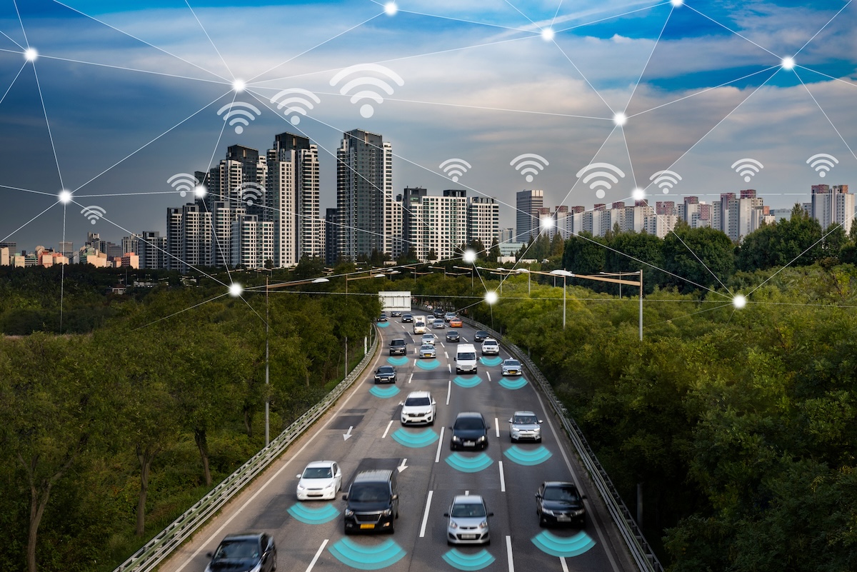
Localization is a critical component of autonomous vehicle (AV) technology, ensuring that AVs know their exact position in the world. This capability is essential for safe navigation, precise maneuvering, and efficient route planning. Accurate localization combines various sensors and algorithms to determine the vehicle’s location relative to a map, which needs to be within centimeter-level accuracy. Understanding these systems is crucial for grasping the complexities of autonomous driving.
Despite significant advancements, localization for AVs still faces several challenges:
- Environmental Variability: Weather conditions like rain, heavy fog, and snow can impair sensors.
- Urban Canyons and Forest Canopies: Tall buildings in cities and high density of trees can obstruct or reflect GPS signals, leading to inaccuracies known as multipath errors.
- Map Dependence and Maintenance: Keeping pre-existing HD maps up to date is challenging, especially in rapidly changing environments.
- Cost and Scalability: High costs and the need for large-scale deployment pose economic challenges.
- Edge Cases: Unusual scenarios like tunnels, areas with limited features, and multi-level roads are challenging.
Enabling Autonomous Localization
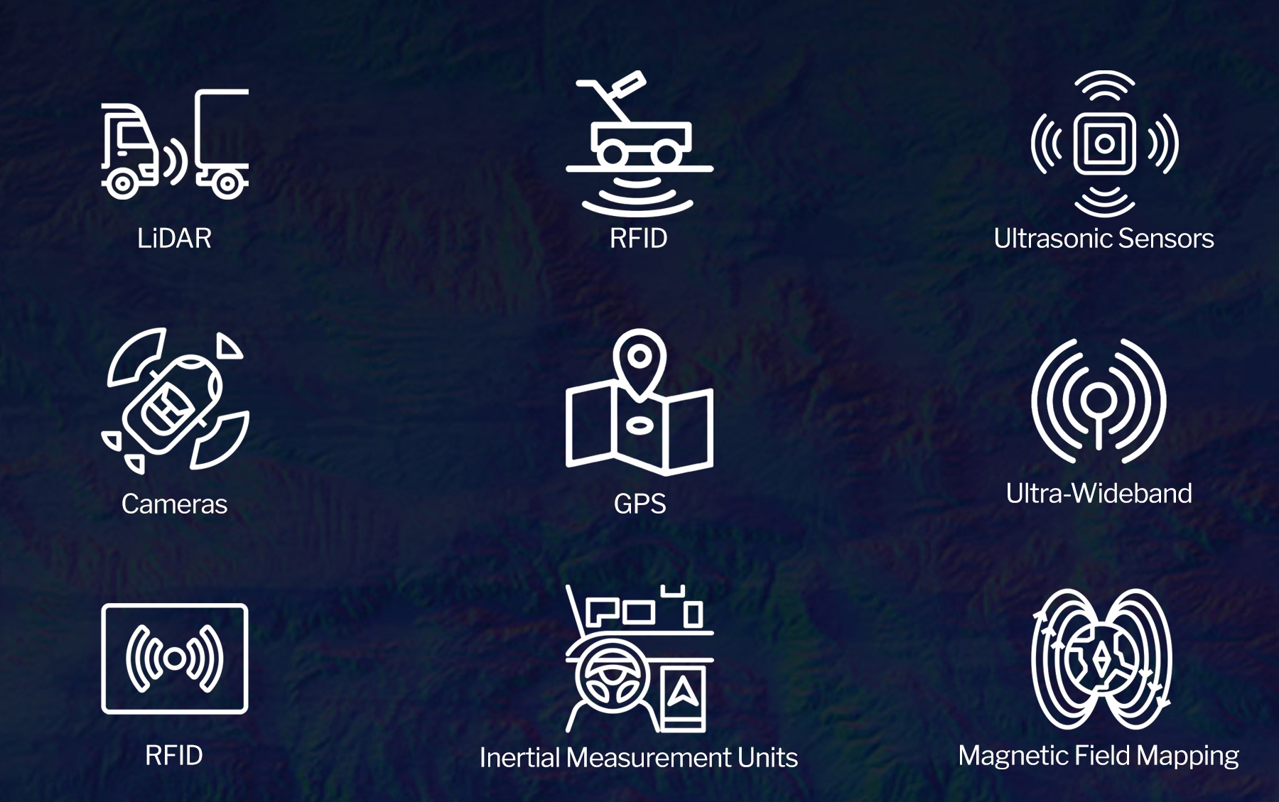
For the purposes of this guide, we’ll compare the pros and cons of the following key technologies that enable precise positioning and orientation:
Global Positioning System (GPS): GPS provides a foundational positioning system, using satellite signals to determine the vehicle’s location. Enhanced forms like Differential GPS (DGPS) offer improved accuracy by correcting errors in the satellite data.
LiDAR: LiDAR (Light Detection and Ranging) uses laser pulses to create detailed 3D maps of the environment. It is highly accurate in measuring distances and identifying objects.
Cameras: Cameras capture visual information, allowing AVs to detect lane markings, traffic signs, and obstacles. Computer vision algorithms process these images to aid in localization.
Inertial Measurement Units (IMUs): IMUs track the vehicle’s acceleration and rotation, providing data on movement and orientation. They are particularly useful in environments where GPS signals are weak or unavailable.
Ground-Penetrating Radar (GPR): GPR, such as the WaveSense system, maps the subsurface features of the road. This technology is less affected by weather conditions and changes in the above-ground environment, offering a reliable localization method.
Ultrasonic Sensors: Ultrasonic sensors use sound waves to detect nearby objects, which are useful for close-range localization and obstacle avoidance, especially during low-speed maneuvers.
Radio Frequency Identification (RFID): RFID tags embedded in the road can provide additional localization data, particularly in controlled environments like warehouses or ports.
Ultra-Wideband (UWB) Technology: Provides highly accurate short-range positioning, especially useful for precise maneuvering in controlled environments like parking structures or logistics centers.
Magnetic Field Mapping: This technique utilizes the unique magnetic field signatures of road segments, supplementing other sensors in areas where they struggle, like tunnels or indoor environments.
The Pros: Established Wins of Positioning Technologies
GPS
- Global Coverage: Available almost everywhere.
- Mature Technology: Well-established with ongoing improvements.
- Cost-Effective: Standard GPS units are relatively inexpensive.
LiDAR
- High Accuracy: Excellent at creating detailed 3D maps.
- Object Detection: Effective in identifying and classifying objects.
- Independence from Light: Functions well in low-light conditions.
Cameras
- Visual Context: Provides rich visual information for decision-making.
- Versatility: Can be used for multiple applications beyond localization.
- Cost-Effective: Affordable and widely available.
IMUs
- Robustness: Reliable in environments where other sensors might fail.
- High-Frequency Data: Provides continuous data on movement and orientation.
- Compact Size: Small and easy to integrate into various platforms.
GPR
- Weather Agnostic: Performs well in adverse weather.
- Surface Independence: Mapping below the surface removes reliance on ever-changing surface conditions or markings.
- Agile: Less affected by surface changes, providing more stable maps and longevity for localization.
Ultrasonic Sensors
- Affordability: Inexpensive and widely used.
- Close-Range Accuracy: Excellent for detecting nearby objects.
- Simplicity: Easy to integrate and use.
RFID
- Precision: Highly accurate in controlled environments.
- Reliability: Consistent performance in designated areas.
- Security: RFID systems can offer enhanced security features.
UWB Technology
- Close-Range Accuracy: Extremely high accuracy for short-range positioning.
- Low power consumption: Compared to other active sensing technologies.
- Multipath Resistant: Making it suitable for complex environments.
Magnetic Field Mapping
- All-Weather: Immune to visual obstructions or weather conditions.
- Consistency: Provides consistent performance over time with minimal infrastructure.
The Cons: Challenges of Each Technology
GPS
- Signal Blockage: Can be obstructed by buildings, trees, and tunnels.
- Atmospheric Interference: Weather affects signal quality.
- Multipath Errors: Reflections off surfaces cause inaccuracies.
LiDAR
- Costly: High expense for high-resolution units.
- Weather Sensitivity: Performance degrades in rain, fog, or snow.
- Data Processing: Requires significant computational resources.
Cameras
- Lighting Conditions: Performance can be affected by poor lighting or glare.
- Weather Sensitivity: Fog, rain, and snow can impair visibility.
- Computational Load: High demand for processing visual data in real-time.
IMUs
- Drift Over Time: Accumulation of small errors can lead to significant inaccuracies without frequent calibration.
- Cost: High-quality IMUs are expensive.
GPR
- Form Factor: Chassis must be able to support the sensor size without issue.
- Integration: Requires integration with other systems for optimal navigation performance.
- Novelty: A new method for addressing localization can lead to resistance.
Ultrasonic Sensors
- Range: Limited to short distances.
- Interference: Susceptible to interference from other ultrasonic sources.
- Resolution: Lower resolution compared to LiDAR or cameras.
RFID
- Infrastructure: Requires installation of tags, which can be costly and labor-intensive.
- Range: Limited to specific areas where tags are deployed, making scaling difficult.
UWB Technology:
- Limited range: Typically, effective only within 100 meters.
- Infrastructure: Requires installation of UWB beacons in the environment.
- Interference: Potential for signal interference in complex environments.
Magnetic Field Mapping:
- Upfront Investment: Requires highly detailed mapping of magnetic field variations.
- Interference: Can be affected by large metal objects or electromagnetic interference.
- Accuracy: Limited accuracy compared to some other methods.
Technologies Working Together to Provide Localization
Effective localization in autonomous vehicles will ultimately require sensor fusion, where data from multiple sources are combined to create a comprehensive understanding of the vehicle’s environment. The key to effective sensor fusion lies not just in combining data, but in understanding each sensor’s strengths, weaknesses, and error characteristics.
Just a few examples of how different technologies complement each other are:
- GPS and IMUs: GPS provides global positioning, while IMUs offer high-frequency movement data, helping to maintain accuracy when GPS signals are weak.
- LiDAR and Cameras: Cameras’ visual context enhances LiDAR’s 3D mapping capabilities, improving object detection and classification.
- GPR and LiDAR: GPR provides stable subsurface data, complementing LiDAR’s surface mapping, especially in challenging environments.
- Ultrasonic Sensors and Cameras: Ultrasonic sensors handle close-range detection, while cameras provide broader visual information.
- RFID and GPS: RFID tags can offer precise localization in specific areas, enhancing GPS accuracy in complex environments.
Forecast for Autonomous Vehicle Localization
The key trends we’re looking out for include:
- Improved Sensor Fusion: Enhanced algorithms will provide more accurate and reliable localization by better integrating data from diverse sources.
- Cost Reduction: As technology matures and scales, the cost of high-precision sensors will decrease, making advanced localization systems more accessible.
- Enhanced Maps: Continued development of HD maps with real-time updates will support more accurate and dynamic localization.
- Edge Computing: Utilizing edge computing for real-time data processing will reduce latency and improve response times.
- Collaborative Localization: Vehicles will increasingly share localization data and with infrastructure, enhancing overall accuracy and reliability.
- Subsurface Mapping: Increased adoption of GPR technology will provide a stable foundation for localization in all weather conditions.
As the field evolves, we can expect autonomous vehicles to achieve unprecedented levels of safety and efficiency, operating seamlessly in diverse environments. Localization technologies will be at the forefront of this transformation, enabling AVs to navigate the world with precision and confidence.
At GPR, we’re leading the way in localization technology for automated driving by creating long-lasting, high-definition maps of road and off-road subsurfaces. Our maps are protected by the ground and remain accurate in even the most challenging environmental conditions. Contact us to learn more about GPR for localization.