Understanding Ionospheric Scintillation and AV Localization
What is Ionospheric Scintillation?
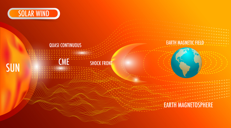
Ionospheric scintillation is the rapid fluctuation of radio signals caused by irregularities in the ionosphere’s electron density. These irregularities result from massive energy releases from the Sun, such as solar flares and coronal mass ejections (CMEs), which send high-energy particles into Earth’s atmosphere, disrupting the ionosphere. The ionosphere, a region of the upper atmosphere extending from about 50 km to 1,000 km above the Earth’s surface, contains free electrons that can scatter and refract signals, particularly from Global Navigation Satellite System (GNSS) satellites, leading to signal distortion and reduced accuracy.
There are two primary forms of ionospheric scintillation: Amplitude Scintillation (S4 Index) and Phase Scintillation (σφ). Amplitude Scintillation causes rapid variations in signal strength that lead to sudden drops or complete loss of GNSS signals. Phase Scintillation disrupts the carrier phase of GNSS signals, making it difficult for receivers to maintain lock and leading to positioning errors.
What does this mean in layman’s terms? Imagine shining a flashlight through a swimming pool— the water acts like a lens, bending, reflecting, and distorting the light. As the water moves, the level of distortion changes. The same thing happens to satellite signals during ionospheric scintillation—the ionosphere acts like a shifting lens, bending and scattering the signals, making them flicker or weaken. Additionally, the signals may get smeared over a large area, reducing their accuracy and rendering them inaccurate and unreliable for navigation.
When and Where?
Ionospheric scintillation is most likely to occur during periods of high solar activity and around the equinoxes (March and September). During these times, the Earth’s geomagnetic field and axis tilt relative to the Sun increase plasma instability and enhance scintillation events.
- Solar Cycles: Scintillation intensifies during solar maximum, which occurs approximately every 11 years when sunspot activity peaks.
- Geographical Hotspots: The most affected regions include the equatorial zones (20°N-20°S) and high-latitude areas near the polar regions, where geomagnetic storms exacerbate the disturbances.
How Does it Affect GNSS?
Different GNSS constellations respond to scintillation differently. GPS and Galileo are more susceptible to scintillation in equatorial regions. BeiDou and GLONASS can offer slightly better resilience due to multiple-frequency signals but still experience disruptions.
For industries relying on any GNSS though, ionospheric scintillation can be a costly and debilitating phenomenon.
GNSS receivers may struggle to maintain lock on satellites, leading to intermittent or complete outages and signal loss. This can introduce errors ranging from sub-meter to tens of meters, impacting precision applications.
Even high-accuracy GNSS techniques like Real-Time Kinematics (RTK) and Precise Point Positioning (PPP) suffer severe disruptions, rendering autonomous operations unreliable.
Industries Most Affected by Ionospheric Scintillation
Several industries rely on precise localization for operations, making them particularly vulnerable to ionospheric scintillation:
- Autonomous Vehicles & Robotics: Autonomous vehicles often depend on highly accurate GNSS signals for navigation. Scintillation-induced GNSS disruptions can cause erratic behavior and compromise operations and safety.
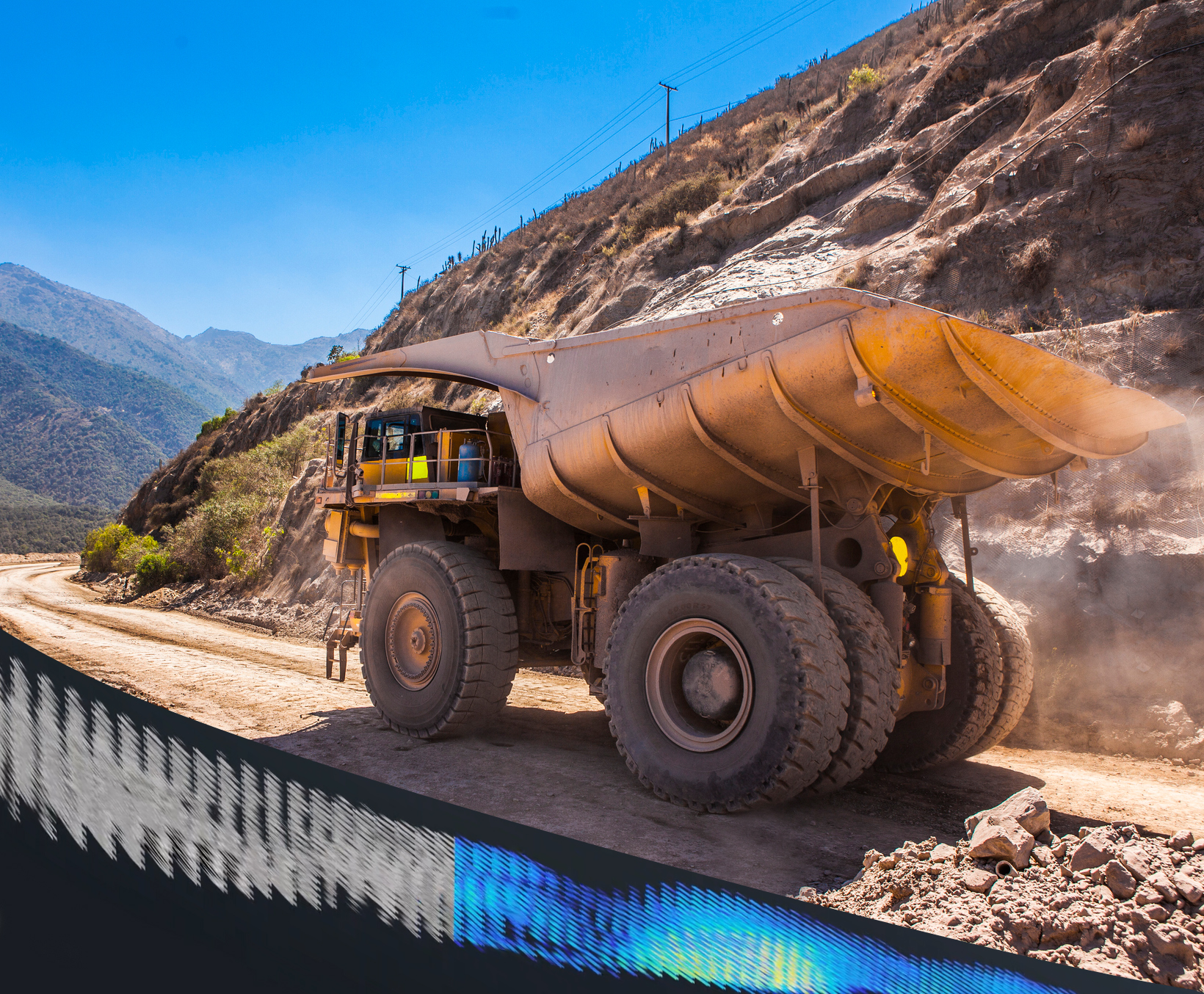
- Mining: Mining operators increasingly rely on autonomous haulage systems and other automated operations. In these environments, precise positioning is critical for drilling, blasting, and vehicle navigation tasks. Disruptions caused by scintillation have an immediate and direct impact on operations, as the loss of localization typically brings the entire fleet to a complete stop for safety reasons. This results in severe operational delays, increased costs, and heightened safety risks.
- Aviation & Aerospace: Commercial and military aircraft utilize GNSS for navigation. Disruptions can impact automated landing systems and air traffic management.
- Maritime Operations: Ships and offshore platforms rely on GNSS for precise positioning. Signal degradation can lead to navigation errors, particularly in remote or high-latitude locations.
- Precision Agriculture: Automated farming equipment depends on precise localization to optimize planting, harvesting, and irrigation. GNSS errors can reduce efficiency and crop yield. Or even turn vehicles into “demon-possessed machines.“
- Defense & Military Applications: Military operations using drones, guided munitions, and GPS-dependent communications face serious risks when scintillation disrupts signals.
Impacts on Automation and Autonomous Operations
In severe cases, scintillation can completely block GNSS signals, leading to prolonged outages. When GNSS signals are lost, autonomous systems may be left without an accurate localization reference, increasing the likelihood of operational failures. These disruptions can be particularly hazardous in environments where continuous, real-time positioning is essential, such as high-speed logistics or defense operations.
In one study, operations at a Brazilian mining company located in Minas Gerais state were halted for an average of 2.5 hours per day between October and November 2022 due to scintillation effects.
Beyond outages and inaccuracies, scintillation also threatens safety-critical applications. Industries like defense, mining, and heavy industry depend on stable localization for safe and reliable operation. GNSS interruptions in these fields can cause severe consequences, including operational delays, inefficiencies, or even accidents. When autonomous systems cannot maintain precise positioning, the risk of collisions, route deviations, and stalled operations increases dramatically.
Given these risks, autonomous industries must integrate alternative, innovative localization solutions to ensure resilience in GNSS-denied environments.
How GPR’s WaveSense Technology Overcomes Ionospheric Scintillation
Unlike GNSS, WaveSense does not rely on satellites for positioning at all. Instead, the solution leverages ground penetrating radar to localize vehicles based on stable subterranean features. This makes it inherently immune to ionospheric scintillation and other surface vulnerabilities.
- Independent of Atmospheric Conditions: GPR scans the unique subsurface composition beneath roads and terrain protected from surface conditions.
- Uninterrupted Positioning in GNSS-Denied Environments: WaveSense continues to provide precise localization where GNSS fails, including in tunnels, under dense foliage, or in urban canyons.
- Centimeter-level Accuracy: Unlike GNSS, which can suffer from meter-level errors during disturbances, WaveSense maintains highly accurate positioning regardless of external disruptions.
The Future of Resilient Localization Technologies
As industries increasingly adopt autonomous systems, relying solely on GNSS is no longer a viable option. The growing frequency and intensity of ionospheric disturbances highlight the urgent need for robust, alternative localization technologies. GPR provides a stable, infrastructure-free solution that ensures uninterrupted, high-precision positioning even in the most challenging environments.
For industries operating in mining, defense, logistics, trucking, and beyond, investing in resilient localization is crucial to maintaining operational efficiency, safety, and reliability. As the global demand for autonomy grows, solutions like WaveSense will be pivotal in ensuring vehicles can navigate seamlessly—regardless of external disruptions. The future of autonomy depends on localization systems that work anywhere, anytime, without compromise.